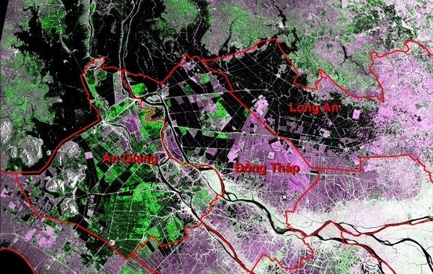
Analysis of the satellite images shows that in 2018 floods appeared earlier in the Mekong Delta than for many years and developed in a complicated manner. By using the radar image, it is possible to quickly identify areas of flooding.
Photo taken on July 5 shows no floods.
On July 11 and July 17, floods occurred in the upstream (black areas) as the flow of the upper Mekong flowed into the Mekong River Delta at a higher level than the average of many years combined with the tides, causing the water level of the Mekong to rise up quickly.
Photo taken on August 4 shows flood waters upstream, some areas of Dong Thap and Long An provinces have been flooded. According to the National Meteorology and Hydrology Centre, the highest water level measured on August 7 at the Tien River at Tan Chau (An Giang) was 3.26 metres, while on the Hau River in Chau Doc (An Giang) it was 2.59 metres.
Photos on August 16 and 22 showed that the floods had spread in An Giang, Dong Thap and Long An provinces
Photos on August 28 and September 3 (black on the photo is submerged).
Photo on September 9 showed that the flooded areas were more widespread than the previous photo.

.jpg)
.jpg)
.jpg)


.jpg)
.jpg)