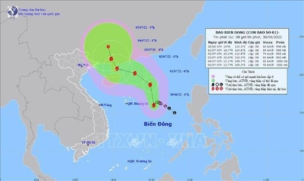
At 7am on June 30, the eye of the storm, internationally named CHABA, was about 430km from Vietnam's Hoang Sa (Paracel) archipelago. The strongest wind near its eye was 62-74 km per hour.
The storm is forecast to mostly move northwest at a speed of 10-15km per hour between July 1 and 3.
By 7am on July 3, the storm is predicted to see the strongest wind close to its eye reaching level 9 (75-88km per hour), with gusts at level 12.
By 7am on July 4, it will change its direction to move north-northwest with a speed of about 5-10 km, with the intensity tending to weaken.


