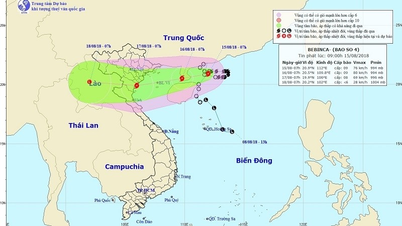
The fourth storm to affect Vietnam this year is forecast to make landfall on August 17, according to the national meteorological service.
As of 7h00 on the morning of August 15, Bebinca was located at 20.9 degrees north latitude and 112 degrees east longitude with a maximum wind speed of 76 kilometres per hour.
Due to the impact of the tropical storm, medium to heavy rains are expected in the northern and north-central regions from the night of August 15 to August 17, which could trigger flash floods and landslides in mountainous provinces.
The provinces most vulnerable to landslides and flash floods are Lai Chau, Son La, Hoa Binh, Yen Bai, Phu Tho, Quang Ninh, Lang Son, Cao Bang, Thanh Hoa and Nghe An.
Meanwhile, low-lying areas in the Red River Delta are at risk of being inundated.
Ahead of Bebinca’s landfall, the Central Steering Committee for Disaster Prevention visited the provinces of Hoa Binh, Son La, Dien Bien and Lai Chau to inspect their preparation.
The authorities in Quang Ninh province have asked local vessel owners to securely anchor their ships and for aquaculture farmers to reinforce their installations, while not allowing anyone to remain on the ships or farms when the storm makes landfall.


