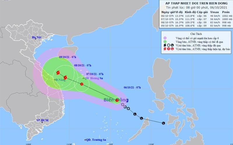
Accordingly, at 7 am on October 6, the tropical depression was at about 250 km to the north of Song Tu Tay Island (under the Vietnam’s Spratly Archipelago), with the strongest winds near its centre blowing at 40-50km/h).
It is forecast that in the next 24 hours, the tropical depression will move westward at about 20km per hour and may become stronger.
By 7 am on October 7, the tropical depression’s centre is projected to be about 15.5 degrees north latitude and 111.5 degrees east longitude in the waters south of Hoang Sa (Paracel) Archipelago. The strongest winds in the area near the centre of storm are expected to be about 50-60km per hour (level 9).
Over the following 24 to 48 hours, the tropical depression is likely to move west-northwest, traveling at a speed of about 10-15km every hour, while growing into a storm.
By 7 am on October 8, the storm’s centre will be located at about 13.5-19.0 degrees north latitude and 107.0-113.0 degrees east longitude.
Heavy rain, thunderstorms, strong winds and rough seas with waves 2-3m high are expected in the middle part of the East Sea.
Showers, thunderstorms, tornadoes and strong gusts are likely to occur in the waters off the Gulf of Tonkin and the waters off provinces from Quang Tri to Ca Mau, Ca Mau to Kien Giang, the Gulf of Thailand, and the East Sea area (including the waters of Vietnam’s Truong Sa and Hoang Sa Archipelagoes).


