It is forecasted that over the next 24 hours, the low-pressure area will move slowly to the northwest, at 5-10 km per hour and is likely to strengthen into a tropical depression.
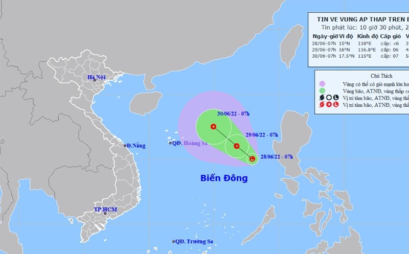
At 7 am on June 29, the location of the low-pressure area will be about 600 km east-southeast of Vietnam’s Hoang Sa archipelago.
The strongest winds near the eye of the tropical low-pressure area were at level 6 (40-50km/hour) and the shock level was 8.
All vessels operating in the danger zone are at high risk of being affected by strong winds, with its disaster risk at level 3.
In the next 24 to 48 hours, the tropical low-pressure will continue to move slowly to the northwest, at 5-10 km per hour.
At 7 am on June 30, the location of the low-pressure area will be about 470 km east-southeast of Vietnam’s Hoang Sa archipelago. The strongest winds near the eye of the tropical low-pressure area were at levels 6-7 (40-60km/hour) and the shock level was 9.


