According to the hypothetical situation, at 8.45am on December 26, the Pacific Tsunami Warning Centre broadcast tsunami warnings to the entire East Sea, including Vietnam’s coastal strip. The tsunami altitude was projected to fluctuate from 1.5m to over 7m, depending on each region. The tsunami attack duration started from 8.55am to 12.30pm, depending on each location. For Vietnam, it was forecast that the area from Da Nang city to Quang Ngai province would suffer the biggest impacts with wave heights above 5m and attack time from 10.30am to 12.30pm.
Receiving the information, from 9am to 9.41am on the same day, the Institute of Geophysics delivered three tsunami warning messages in the form of text messages to mobile phones of those on duty and radioed them on the multi-target disaster warning system at 30 stations located in the coastal localities of Da Nang to request the immediate evacuation of the people.
Addressing the drill, Tran Quang Hoai, standing member of the central steering committee, said that disaster developments in the world and in the region are increasingly extreme and abnormal, including earthquakes and tsunamis.
Despite no cases being recorded in the past, there remain risks of tsunamis in Vietnam due to cracks in the Manila deep sea trough (Philippines), he said. If a tsunami occurs, the duration of its hitting Vietnam will be around two hours, and the sea areas in 13 provinces from Ha Tinh to Ba Ria-Vung Tau will be highly at risk of being affected, Hoai added.
The Prime Minister issued Decision No. 430/QD-TTg dated April 12, 2012, approving a project on building a tsunami warning lookout systems for high-risk areas, with the first phase to be piloted in Da Nang and Quang Nam. So far, the project has finalised the construction of 51 stations – 30 in Da Nang and 21 in Quang Nam.
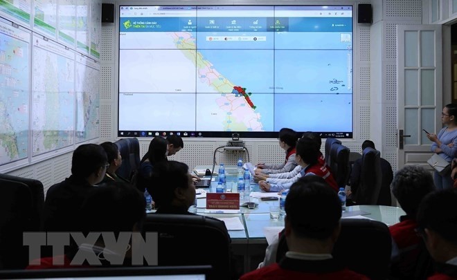
Pham Hong Thanh, director of the multi-target disaster warning system project, said that this is a modern science and technology programme which is developed and provided by military-run telecom group Viettel, and is put into use to exploit tsunami warnings in order to minimise damage. The warning system includes a loudspeaker system (a maximal range of 1-2km depending on weather conditions) and the five-colour warning light system (according to five levels of disaster risks).
Hoang Duc Cuong, Director of the National Centre for Hydro-Meteorological Forecasting, assessed that the exercise basically met the requirements, but the contents of warning messages should be more drastic so that all levels, sectors and people will be proactive in their response. The messages should clearly tell the time, venue and level of tsunami risks in order to take response measures to any situation.


