The documents are grouped into maps, pictures, books and magazines published in Vietnamese, French, Latin, and Chinese languages.
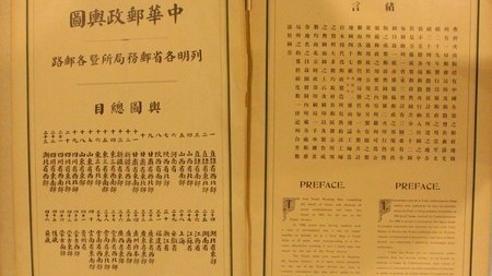
Notable among those are documents, written by Chinese historians and published from 1178 to 1951, showing that Hoang Sa and Truong Sa were not parts of China’s territory.
Showing the same fact, a historical textbook published in 1950 in Beijing stating that Hainan Island was the southernmost end of Chinese territory. Hoang Sa and Truong Sa archipelagos were not featured in the map of China which was drawn in this book, and in other maps published in Japan and France in late 19th and early 20th centuries.
A map of Indochina drawn by French people in early 20th century showed that Hoang Sa belonged to Vietnam.
The exhibits have huge value in providing scientific and historical evidences asserting Vietnam’s sovereignty over Hoang Sa and Truong Sa archipelagoes.
The exhibition will last through September 8 at 26 Ly Thuong Kiet street, Hoan Kiem district.


