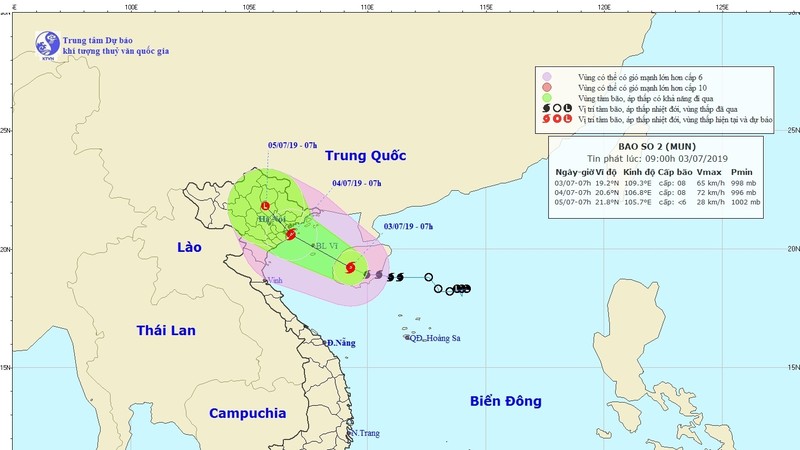
As of 7am on July 3, tropical storm Mun was located at about 340 kilometres of the coast between the provinces of Quang Ninh and Nam Dinh, with wind speeds of 62-74 km/h near its eye and gusts of 103-117 km/h.
The storm was on the western area of China’s Hainan Island, about 220 kilometres from Vietnam’s Bach Long Vi Island.
Mun is forecast to move in the north-northwest direction over the next 24 hours at speeds of 10-15 km/h and is expected to make landfall on Vietnam’s northern coast on the morning of July 4.
The storm is expected to bring strong winds and torrential rains across northern Vietnam over the next several days.
The Gulf of Tonkin, including the islands of Bach Long Vi, Co To, Cat Hai and Van Don, are projected to see exceptionally rough seas and winds of 62-74 km/h.
Torrential rains are expected to hit the Red River Delta and the northern mountainous region over the next two days, with a high risk of landslides and flooding.


