Under the master plan for Ho Chi Minh City through 2040, with a vision to 2060, the Sai Gon River will be placed at the centre of development. The city has an opportunity to comprehensively establish riverside spaces, turning the river into an overarching landscape development axis across multiple areas of a megacity.
An urban area closely connected with waterways
Throughout history, Sai Gon-Ho Chi Minh City has always been an urban area closely connected with waterways. Architect and Doctor of Science Ngo Viet Nam Son said that this has been a river-based urban area since ancient times. The Sai Gon River once served as a route bringing goods and people to the urban area. It was where ports and residential areas were formed, while also preserving important traces of the city's formation and development.
However, the process of riverside development has lacked comprehensive planning, leaving many sections in a situation where the river has been “claimed as private property” and lacking riverside public transport routes.
According to the Department of Construction, the current orientation for adjusting the master plan focuses on establishing a riverside corridor, particularly in the central area from Ben Nghe and Thanh My Tay to An Khanh and Thao Dien. These areas will form a chain of public facilities — including parks, squares, pedestrian walkways, and community spaces — thereby expanding views towards the water, increasing greenery, and creating connections between nature and the urban area.
In recent years, Bach Dang Wharf has become a destination featuring a pedestrian space, a high-speed boat terminal, river buses, and service and tourism activities. Opposite it is the dozens-of-hectares Thu Thiem Riverside Park, which has been transformed from a low-lying riverside area into an open space serving cultural, sports, and community activities. Alongside these, Landmark 81, Vinhomes Central Park, the Ba Son area, and the new Thu Thiem urban area have created a new skyline, with the Sai Gon River providing its focal point.
These developments show that the Sai Gon River is gradually becoming a central element in the urban landscape structure. However, for the Sai Gon River to truly become central to the city's development landscape, several new and stringent requirements must be met.
Planning development through a river-based urban approach
According to experts, one of the core issues in planning for the Sai Gon River is to shift from an approach of developing individual plots of land to comprehensive management and development of the entire river corridor. Son said the city should not allow a “wall of high-rise buildings” to form along the river. Architecture should gradually become lower towards the water to ensure that riverside space is available to the community.
At the same time, waterway transport must be reorganised in a more orderly and efficient manner. From this perspective, he proposed viewing the Sai Gon River as the backbone landscape axis of the entire urban area, while also making it a green focal point for the city. The riverside space could be envisioned as the urban area's “living room”, where people meet, socialise, and participate in cultural and community activities.
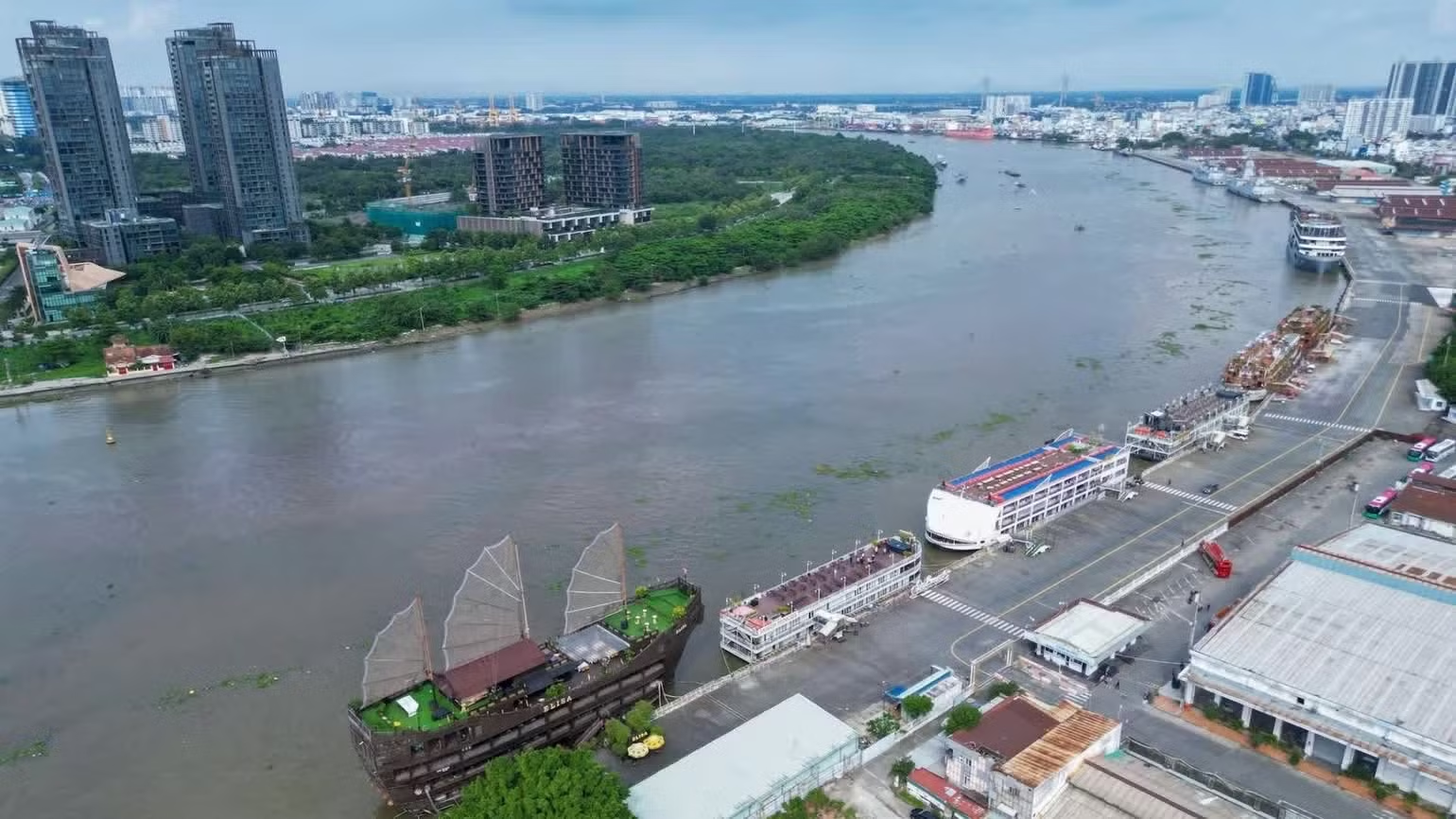
From the perspective of green-space development, Le Hoang Chau, Chairman of the Ho Chi Minh City Real Estate Association, said that with a corridor extending 100-200m from the high-water edge along about 80km of the Sai Gon River, planning for both banks could create a land fund of 3,100-5,000ha, including about 2,000ha of river surface area. If about 60% of this land fund were allocated to parks and greenery, the city could add 1,800-3,000ha of land for this purpose.
The remaining area could be used for transport, services, and public spaces serving the needs of city residents. Similarly, the river embankment and riverside service economy development project for the 2020-2045 period is expected to lay the foundation for the development of the Sai Gon River as the city establishes a specific roadmap.
In the first phase, the project focuses on renovating and upgrading the river corridor, developing management regulations and implementing green infrastructure projects combined with tourism and services. In the following phase, from 2025 to 2045, the city will continue investing in green infrastructure, integrating tourism, the service and entertainment economy, and completing the legal framework, while regularly reviewing and updating plans in line with the city's pace of development.
The initial results of the project's implementation have been positive, with a series of projects contributing to the formation of a new appearance for the Sai Gon River corridor. Phase 2 of Ba Son Park is planned to add green space, a square, and a boat landing.
Notably, the Nha Rong Wharf-Khanh Hoi Cultural Park and Bach Dang Wharf public greenery project has recently broken ground, aiming to restructure the riverside space in connection with historical heritage. According to architect Vo Kim Cuong, expanding Ho Chi Minh cultural space around Nha Rong Wharf is significant both historically and culturally.
In the context of a shortage of parks and green spaces and frequent traffic pressure, allocating land for public spaces is a choice geared towards long-term benefits. In the long term, many experts believe that the Sai Gon River must be viewed beyond administrative boundaries.
Riverside planning needs to harmoniously combine the economy, transport, culture, and heritage conservation, while also connecting infrastructure with localities in the former Binh Duong area and Dong Nai City to form an inter-regional development corridor.
From a regional planning perspective centred on waterways, Dr Nguyen Thi Hau, General Secretary of the Ho Chi Minh City Association of Historical Sciences, said that planning the expanded city according to a river-based urban regional model is not merely a short-term project but a long journey requiring substantial investment, strategic vision, and consensus from both the authorities and the community. This is the key to making Ho Chi Minh City one of the liveable and sustainably developing urban areas in the region.
At present, climate change is an important reason for the city to focus on a river-based urban approach. As this is inherently a low-lying downstream area strongly affected by high tides, restoring its water-based structure is not only a requirement for cultural preservation but also a survival strategy for an urban area in the downstream region of southern Viet Nam. The development of a master plan for Ho Chi Minh City with a 100-year vision must be based on this important characteristic.
In practice, planning around waterways is not simply a matter of upgrading the landscape but of establishing the relationship between people and the city's natural and historical spaces. It is also a way for the city to turn a natural advantage into a foundation for sustainable development by using the river as a landscape axis, public space as the centre, and history and culture as its depth, while maintaining harmony with transport, the economy, and ecology.