Mapping flood risk with remote sensing technology
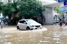
Flooding is becoming a major challenge for Ha Noi, as rapid urbanisation expands concrete coverage and reduces the city’s natural drainage capacity. The application of remote sensing technology and geographic information systems (GIS) has opened up a new approach, enabling the identification, mapping and forecasting of areas at risk of inundation.