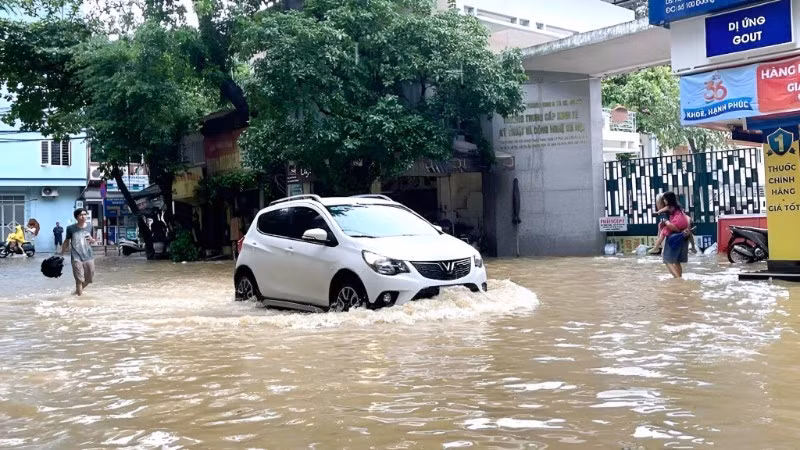
In late August 2025, Ha Noi endured a devastating downpour caused by Typhoon Kajiki, which left large parts of the city submerged. The deluge overwhelmed the drainage system, but what is more worrying is the disappearance of many lakes and ponds, which are natural water-retention areas, due to urbanisation.
At the same time, the city’s drainage planning remains inconsistent. Interestingly, some old quarters, despite outdated infrastructure, rarely flood during heavy rains, showing that sound planning is decisive for flood resilience.
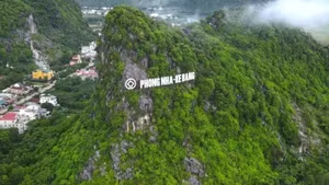
Flooding usually occurs on a wide scale, making it difficult to monitor comprehensively using ground-based methods. Only satellite observations provide a complete overview. In areas with complex terrain, such as high mountains that are difficult to access, satellite images are the only tools capable of providing consistent and objective data.
Significantly, the historical archive of up to 40 years constitutes an invaluable information bank for analysing long-term environmental and topographic changes.
To study flood risk, scientists combined remote sensing data with GIS. Satellite imagery from DMC L1R and SPOT5, with resolutions ranging from 10 to 32 metres, was processed, corrected and overlaid with topographic data (DEM), recorded rainfall, and transport networks.
Using near-infrared (NIR) thresholding, researchers extracted inundated areas during the historic rainfall of November 2008. The flooded sites were then catalogued and added to an analytical model. Data layering allowed precise identification of roads, residential zones and urban areas frequently affected by flooding.
Findings showed that although rainfall in subsequent years was far lower than in 2008, flooding in Ha Noi still occurred extensively, particularly in areas at elevations of 1 to 3.8 metres. Streets such as Pham Van Dong, Pham Hung, Tay Son-Thai Ha, Pham Ngoc Thach, Dai La, and Huynh Thuc Khang were identified as hotspots for inundation.
By integrating satellite data, DEM and GIS, the research team built 3D models providing a clear visual representation of areas vulnerable to heavy rainfall. This serves as a valuable tool for policymakers in planning urban development, infrastructure investment and disaster prevention.
According to the National Remote Sensing Department, the greatest advantage of remote sensing technology lies in its broad coverage and ability to deliver continuous, objective information. When combined with GIS, the data extend beyond current conditions to support modelling and forecasting, thus enabling more scientific urban management.
")
By overlaying satellite imagery with DEM and transport maps, it becomes possible to model in detail the specific roads and residential areas at risk of flooding – a crucial basis for early warning maps. However, forecasting requires continuous time-series data rather than isolated images, allowing the identification of patterns and more accurate early warnings.
Scientists believe that to improve flood-risk mapping, it is necessary to refine detailed DEM datasets, update large-scale digital elevation models to accurately locate low-lying areas and calculate flood potential, and install IoT monitoring stations in key locations to integrate real-time rainfall and water-level data with satellite imagery.
Cross-sectoral cooperation is also essential. The remote sensing sector should provide satellite data, while infrastructure enterprises share specialised maps and drainage-system charts, so that all can be integrated into a unified database. In addition, dynamic flood-risk maps need to be developed, maps that are not static records but continuously updated, modelling flood scenarios to support forecasting and early warning.
For technology to be effectively applied, suitable policies and legal frameworks must be put in place, with strong investment in weather forecasting systems, drainage simulation models and urban spatial data. The legal framework should be improved so that remote sensing and GIS data are recognised as official grounds in planning approval, environmental impact assessment and construction licensing.
Pham Minh Hai, Deputy Director of the National Remote Sensing Department, said: “We cannot stop the rain, but we can reduce flooding through science. Remote sensing and GIS provide valuable references to effectively support decision-making in urban planning and land-use management.”

![[Video] Promoting solutions to reduce greenhouse gas emissions](https://en-cdn.nhandan.vn/images/dcd63867a0eed4c7753eb4bfb346593abc1ce710dfab8ad1b9aebd75ea6bf930fb76afda60ce3d2f8204f6f674730287b210979a02378495c655160931f18fcc/anh-video.jpg.avif)


![[Video] Potential of carbon credit trading in forestry sector](https://en-cdn.nhandan.vn/images/dcd63867a0eed4c7753eb4bfb346593abc1ce710dfab8ad1b9aebd75ea6bf93000728b0a477dab1009f4f3af29287f2f88aa8218c6fb2f576b28b9a150433872/anh-video-1106.png.avif)