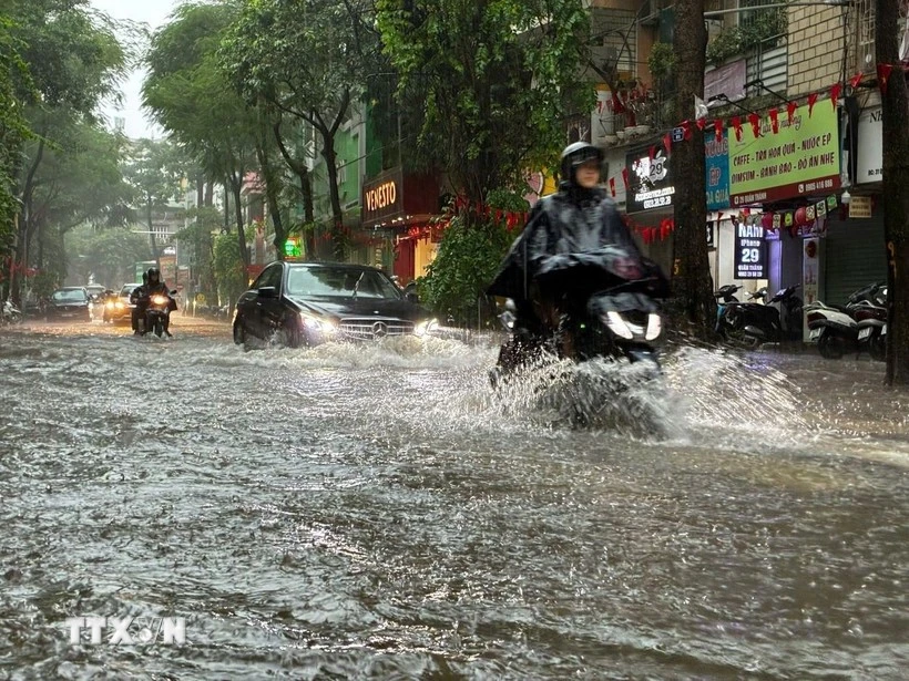
Lam said that Ha Noi is likely to see widespread precipitation ranging from 50-100 mm, and isolated areas potentially receiving over 150 mm. Thunderstorms may also bring the risk of strong winds, lightning, and gusts, he added.
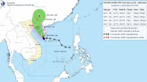
As of 7:00 on October 6, the centre of the tropical depression was located at approximately 22.0°N, 107.1°E, over southern Guangxi Zhuang Autonomous Region of China. The maximum wind speed near the centre was 50-61 km/h, with gusts up to 90 km per hour, moving west at 20-25 km per hour.
By 19:00 on October 6, it is expected to move towards the northern mountainous region of Viet Nam, with winds dropping to below 40 km per hour. It will continue moving northwest at 20-25 km per hour, weakening into a low-pressure area. Affected areas will include the northern Gulf of Tonkin, Quang Ninh, and Lang Son provinces, with a disaster risk at level 3.
Strong wind and high waves are forecast in the Gulf of Tonkin, including Bach Long Vy special zone.
From October 6 through the evening of October 7, heavy rain and thunderstorms are forecast for the northern mountainous and midland regions, with rainfall between 100-200 mm, and localised areas receiving more than 300 mm.
In response, Minister of Public Security General Luong Tam Quang has issued a letter of encouragement to all officers and soldiers, urging them to focus their efforts on dealing with consequences of the previous storm, Bualoi, and stand ready to cope with Typhoon Matmo, ensuring maximum safety for the people.
Noting that between now and the end of the year, Viet Nam is forecast to face 2-4 more typhoons, Quang asked all officers and soldiers to promote the force’s tradition, and continue to serve as a strong shield for the people in the face of adversity and danger.