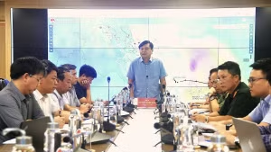
Speaking at a recent forum on the application of science and technology in natural disaster forecasting and early warning, Cao Duc Phat, former Minister of Agriculture and Rural Development, noted that the strong development of science and technology, particularly digital technology and artificial intelligence (AI), is creating new opportunities for the hydrometeorological forecasting sector.
In recent years, Viet Nam has made significant advances in storm monitoring and forecasting thanks to investment from the government, businesses, and international organisations, helping to improve monitoring, forecasting, and early-warning capacity.
Alongside these efforts, digital technology, big data, and AI are opening opportunities in natural disaster monitoring, allowing localities to develop region-specific risk simulations to proactively respond to climate change.
However, natural disasters are becoming increasingly unpredictable and diverse, meaning that monitoring and warning systems still fall short of practical needs.
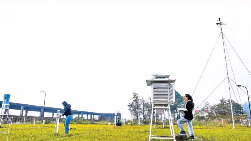
In addition to satellite data, numerous automated devices — such as rain gauges, radars, and sensors measuring temperature, wind, water level, flow velocity, and ground movement — are being deployed, allowing for faster data integration, more accurate area-specific simulations, and timely communication to the public.
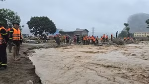
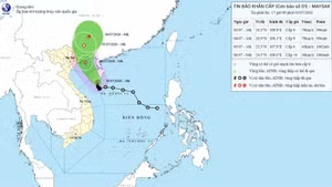
According to the Viet Nam Disaster and Dyke Management Authority, as of the end of November 2025, the country had experienced 20 storms and tropical depressions in the East Sea/South China Sea, matching the record set in 2017.
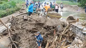
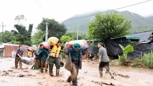
In addition, extreme rainfall and record-breaking floods occurred along 13 river systems in the northern and central regions, causing severe flooding in urban areas and low-lying zones.
As of 24 November, natural disasters nationwide have left 409 people dead or missing, and caused economic losses of over 85 trillion VND (3.2 billion USD).
Alongside efforts to support affected communities in overcoming the consequences of natural disasters, the urgent task now is to seek solutions and enhance the application of science and technology to develop detailed warning simulations for more effective disaster prevention.
Localities need to research and gradually complete flood and landslide risk simulations for each region and severity level to provide proactive warnings, through increased use of science and technology. This will only prove effective when supported by investment in monitoring equipment, warning systems, and a stable, long-term operating mechanism.
Commenting on this issue, Bui Quang Huy, Deputy Director of the Centre for Disaster Prevention Policies and Engineering, said that many places still confuse information technology application with digital transformation. If technology is available but mindsets do not change, systems will continue to operate inefficiently. Early warnings must ensure that people receive them, understand them, know what to do, and are able to act.
The centre is currently piloting a provincial-level natural disaster monitoring system in Ha Tinh, connecting data from the central level to communes and providing an interface for residents to monitor weather conditions, receive alerts, and provide feedback. At the same time, the system assists local authorities in monitoring the evacuation of residents on a digital map.
According to the National Centre for Hydro-Meteorological Forecasting, natural disasters are expected to remain complex and unpredictable from now until the end of 2025, with risks of major flooding in the central region. Localities must focus on overcoming the consequences of recent floods while preparing for upcoming disaster events.
In the short term, it is necessary to increase the density of rain-gauge stations and improve heavy-rain forecasting to support warnings of flash floods, landslides, floods, and inundation. Natural disaster warning maps, especially detailed maps identifying flash-flood and landslide risks down to the village level, must be developed; and high-risk populations in mountainous areas vulnerable to landslides and flash floods, as well as low-lying areas prone to deep flooding, must be reviewed, resettled, and relocated as appropriate. The structure of crops and livestock should be adjusted across regions in a way that is nature-aligned, effective, sustainable, and safer in the face of natural disasters.
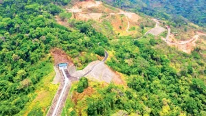
In the longer term, efforts must be strengthened to maintain, upgrade, and renovate dyke systems and reservoirs, especially critical and damaged structures; and investment should be made to improve infrastructure resilience to natural disasters, particularly electricity, telecommunications, and transport infrastructure. Reservoir operating procedures must be reviewed and adjusted, with priority given to reserving capacity to reduce downstream flooding.
Crucially, public awareness and community-based disaster risk management should be further enhanced, especially through strengthened application of science and technology in disaster prevention, including digital transformation and real-time disaster monitoring.