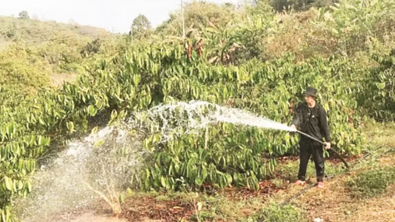
The Central Highlands has a total agricultural production area of more than one million hectares, primarily consisting of perennial crops such as coffee, pepper, cocoa, cashew, and others, in addition to some rice cultivation, annual crops, and other perennial plants.
However, this region is susceptible to drought and water shortages because irrigation systems currently only provide water for approximately 25% of the area requiring irrigation, while about 75% of irrigation-dependent areas rely on rainfall.
The peak drought period in the Central Highlands occurs annually from February to April. Severe drought years typically result from early termination of the previous year's rainy season, late onset of the following year's rainy season, prolonged heat, and cultivation practices that do not consider water source availability.
Nguyen Tung Phong, Director of the Department of Management and Construction of Irrigation Works under the Ministry of Agriculture and Environment, stated: "Over the past 25 years, the Central Highlands provinces have experienced 17 drought episodes, with crop areas commonly affected ranging from 30,000 to 60,000 hectares per episode. The most severe was in 2015-2016, with 338,547 hectares of crops damaged. Localised drought and water shortage conditions affecting approximately 10,000 to 20,000 hectares of crops occur almost every year."
In the Central Highlands, the current area of groundwater aquifers is 34,210 square kilometres with a storage capacity of 6.22 billion cubic metres and an average annual extraction of about 0.5 billion cubic metres. Groundwater resources amount to approximately 9.44 billion cubic metres, with extractable reserves of about 3.55 billion cubic metres.
Nevertheless, between 2010 and 2020, groundwater levels in the region declined by 20 to 50 centimetres. The primary cause is residents drilling wells for agricultural production and domestic use, affecting the groundwater system and geological structure, while the replenishment of groundwater has decreased.
According to the Department of Management and Construction of Irrigation Works, under climate change conditions, surface water sources from reservoirs, rivers, and streams are declining, while rainfall has become irregular and unevenly distributed, affecting groundwater replenishment in this region. Consequently, this will impact irrigation water supply for crops, especially industrial crops in the area.
In recent years, to support the management of water allocation for agricultural production, the Ministry of Agriculture and Rural Development (now the Ministry of Agriculture and Environment) assigned the Department of Irrigation (now the Department of Management and Construction of Irrigation Works) to implement water source forecasting and develop water usage plans to support the management of water supply for agricultural production in the Central Highlands river basins.
The task involved monitoring water sources in irrigation works, assessing drought and water shortage situations, and regularly providing weekly, monthly, and seasonal water source bulletins for local authorities to develop water extraction plans for production.
However, with 75% of production areas lying outside the service areas of irrigation works and water sources primarily dependent on rainfall, managing drought and water shortages in this region currently faces many challenges. Specifically, the diversity in large-scale agricultural production makes it difficult to identify crop areas that have been and are being affected by drought and water shortages over time.
Additionally, calculations, forecasts and warnings for drought and water shortages are mainly carried out for areas within the scope of active water supply from irrigation works. For rainfall-dependent areas, evaluations are primarily conducted through drought, meteorological and hydrological indices, making them highly variable and difficult to forecast long-term.
Therefore, the Central Highlands drought impact assessment project, being tested in Dak Nong and Dak Lak Provinces in 2025, funded by the Food and Agriculture Organisation of the United Nations (FAO) through non-refundable ODA, is expected to help Viet Nam develop methods for monitoring and forecasting drought and water shortages, ensuring irrigation water for agricultural production in this region based on remote sensing technology, with results displayed through an information portal/website. The project will also support the development of water use plans for safer and more efficient production.
The project utilises the WaPOR version 3 tool developed by FAO to analyse satellite imagery at various resolutions, allowing assessment of water use efficiency, drought and water shortage severity, and the sustainability of agricultural activities. This platform effectively supports state management of irrigation, drainage, drought and water shortage prevention, and assists in decision-making to enhance water security and agricultural resilience.
Director Nguyen Tung Phong of the Department of Management and Construction of Irrigation Works said, "This is a pilot model that the Ministry of Agriculture and Environment can replicate nationwide, serving as a basis for responding to climate change impacts and improving the operational efficiency of irrigation works. However, since the project uses satellite image interpretation methods to identify drought and water shortages, the results heavily depend on algorithms and field verification data. Moreover, it is difficult to measure water use as it primarily involves household-scale production using multiple irrigation water sources (surface water, groundwater). Due to the diversity in production and crop distribution depending on changes in the agricultural market, validating remote sensing data requires regional understanding and needs to be carefully designed in the implementation plan."
To implement the project effectively, the Department of Management and Construction of Irrigation Works will work closely with FAO and experts; coordinate closely with local authorities in collecting and verifying satellite image interpretation data; and maximise technology transfer from the project to independently apply annual drought and water shortage predictions for the Central Highlands region. Based on the project outcomes, the Department will continue to propose support from FAO to expand the project results to other regions of Viet Nam.