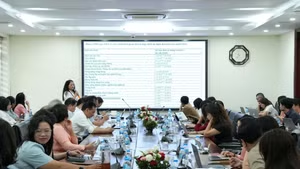
Resolution No. 21-NQ/TW of the third Plenum of the 14th Party Central Committee on the viewpoints and orientations for amending the Land Law and related laws sets out the requirement to build and operate the National Land Information System towards being centralised, unified, synchronised, modern and multi-purpose; ensuring connectivity, interoperability and data sharing with the National Population Database and specialised databases such as those on planning, taxation, notarisation and banking, and real estate...
At the national conference on disseminating and implementing the Resolution of the third plenum of the Party Central Committee, Standing Deputy Prime Minister Pham Gia Tuc emphasised the roadmap: By the end of 2026, the construction of a digital database is to be completed for all land parcels for which information and data have been collected; by the end of 2027, the measurement, preparation of cadastral maps, preparation of cadastral records and construction of the land database are to be basically completed for areas not yet included in the database.
The goal is clear and the deadline has been set. From central to grassroots level, the task is being concretised through decisive approaches suited to the conditions of each locality.
Offices still brightly lit
As night falls, many offices in Lao Cai remain brightly lit. “Everyone is making use of time outside working hours, grabbing a quick meal and working at night to speed up progress,” said Nguyen Thi Huyen Chung, an official at the Yen Binh Area Branch of the Land Registration Office. In Tran Yen Commune, working teams are going to villages to review and supplement information for nearly 7,000 land parcels. Cases in which the land user has not been identified are immediately verified on site in coordination with relevant parties, with the requirement that the data must be “accurate, complete, clean and live”.
In Nghe An, the work is being brought closer to residents. At Hamlet 7, Dai Hue Commune, the hamlet cultural house is packed with people. “We come directly to the hamlet cultural house and carry out the work on Saturdays and Sundays,” said Nguyen Ho Tien, Chairman of the Dai Hue Commune People’s Committee. This approach makes it more convenient for people, particularly those who are busy with work or have difficulty travelling, to supplement and cross-check information. Provincial specialised agencies have also stepped up support, inspections and guidance for the grassroots level.
In Tuyen Quang, the forces involved have been expanded. Teachers, armed forces and mass organisations are coordinating with grassroots authorities. In Son Duong Commune alone, 10 working teams have been established to clean up approximately 39,000 documents. In villages, residents bring their Land Use Right Certificates and citizen identity cards for cross-checking. Officials and teachers also go to the grassroots level to support the collection and standardisation of information.
While Lao Cai is accelerating the work by deploying more time and personnel, Nghe An is bringing the work directly to hamlets, and Tuyen Quang is mobilising all available forces, Hai Phong is focusing on progress control and responsibility. Meetings with localities are held regularly, with requirements to update results, identify bottlenecks, determine delays and clarify the responsibilities of each individual and unit. Director of the Hai Phong Department of Agriculture and Environment Bui Van Thang stressed the requirement that “there must be results every day”.
Meanwhile, in Ho Chi Minh City, an additional requirement has been set: not only to complete the data but also to exploit its value. At Land Registration Office Branch No. 2, land registration dossiers are scanned and uploaded to the management software system.
Deputy Director of Land Registration Office Branch No. 2 Le Xuan Tung said this was an important foundation for improving the efficiency of State management, promoting digital transformation in the land sector and moving towards a modern administration.
Each locality has its own approach, but behind these different approaches lies the same requirement: work quickly but accurately; put data onto the system while ensuring that the data can be used, updated and connected in practice.
Determination to meet the deadline
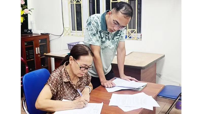
Behind each progress figure is a specific volume of work. It may be a land parcel whose user has not yet been identified, a dossier lacking information, documents prepared during different periods, or discrepancies between records and the actual state of land use.
At the Yen Binh Area Branch of the Land Registration Office, cases in which the land user has not yet been identified must be coordinated and verified on site. Branch Director Nguyen Ngoc Tu said that officials work with specialised agencies to verify the information, providing a basis for entering it into the system and ensuring that the data is “accurate, complete, clean and live”. This shows that building a land database is not simply a matter of entering information into software. Each piece of data must be checked, cross-referenced and subject to accountability for its accuracy.
This is also why the requirement to complete the land database is becoming a task for the entire political system, rather than merely the work of specialised agencies. From the provincial to commune level, from specialised officials to supporting forces, and from management agencies to residents, every link has a role to play in the process of completing the data.
Alongside progress, quality requirements must be placed first. Incorrect data can affect the process of handling administrative procedures; missing information can require dossiers to be supplemented; and an unverified land parcel can interrupt the entire process of data exploitation. Therefore, the goal of “accurate, complete, clean and live” is not merely a technical requirement but also a measure of the quality of the process of building the database.
There is not much time left until the end of 2026, while large areas, complex terrain and cadastral records compiled over different periods still need to be further reviewed and standardised. Differences in progress among localities, and even among communes within the same locality, also require stronger inspections, guidance and support.
The country currently has approximately 106 million land parcels. As of June 29, 2026, around 67.54 million parcels had been synchronised with the national database system, equivalent to approximately 67% of the total number of land parcels. Of these, more than 32.6 million parcels met the “accurate - complete - clean - live” criteria, making them eligible to be put into operation for State management and the provision of public services.
However, from the brightly lit offices in Lao Cai, village cultural houses in Nghe An, working teams in Tuyen Quang, the progress tracking in Hai Phong to the digitisation of records in Ho Chi Minh City, political determination is being translated into concrete actions.
The ultimate goal is not merely to reach a figure by the end of 2026.
Once the land database is completed and connected with population, planning, taxation, notarisation, banking and other relevant databases, land information will no longer remain scattered across paper dossiers. The data can be exploited to support the handling of administrative procedures, assist planning, make the market more transparent, reduce risks in transactions and improve the efficiency of State management.
Each land parcel verified today is a piece of the unified land information system of tomorrow. Every hour worked outside regular working hours and every day off spent going to the grassroots level today are contributing to the creation of an important foundation for modern national governance.