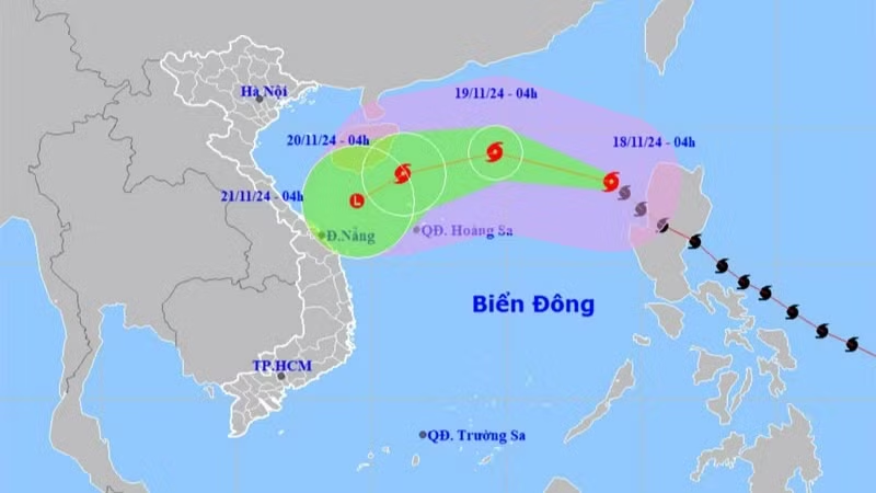
According to the National Centre for Hydrometeorological Forecasting, as of 10 PM on November 17, Typhoon Man-yi was located in the northeastern waters of the East Sea. Its maximum winds near the centre reached level 13 (134-149 km/h), with gust at level 16.
The storm is expected to move northwest and weaken further due to interactions with cold air in the next 24 hours. By 10 PM on November 18 the storm’s centre will be located in the northern East Sea, approximately 440 km northeast of the Hoang Sa (Paracel) Archipelago. It is forecast that winds at that time will reach level 11 (103-117 km/h), with gusts up to level 14.
24–48 hours from now, the storm will shift direction, moving west before turning southwest and continuing to weaken. By 10 PM on November 20 the storm’s centre is expected to be 210 km north of the Hoang Sa Archipelago, with winds at level 8 (62-74 km/h) and gusts up to level 10.
48–72 hours from now, the storm will continue to move southwest and weaken into a tropical depression. By 10 PM on November 21 the centre of the tropical depression will be over the northwestern waters of the Hoang Sa Archipelago. It is then expected to further weaken into a low-pressure area over the central coastal waters of Vietnam.


