Chairman of the Ha Noi People’s Committee Vu Dai Thang signed Decision No. 2512/QD-UBND on May 13 approving the Ha Noi Capital Master Plan with a 100-year vision.
The planning area covers the entire administrative boundary of the Capital, with a total area of approximately 3,359.84 sq km.
The city forecasts Ha Noi’s population will reach around 14-15 million by 2035 and approximately 17-19 million by 2065, while the long-term population ceiling will be capped at no more than 20 million.
Ha Noi will develop under a “multi-layered, multi-dimensional, multi-polar and multi-centre” urban structure, with the Red River serving as the city’s principal ecological and cultural landscape axis.
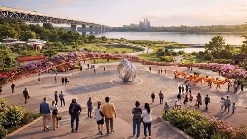
Under the master plan, the “Red River Pole” is identified as a development pole and a special multifunctional landscape space, serving as a centre for culture, finance, commerce, services and tourism, as well as a new growth driver for the Capital.
The city has also designated the “Red River Landscape Boulevard” as a strategic axis and central green space, integrating economic, commercial, service and innovation-driven urban development, alongside science and technology hubs along both riverbanks. According to the plan, this boulevard is expected to become a new symbol of a modern Ha Noi while preserving the cultural identity of Thang Long.
The master plan also aims to strengthen connectivity between both sides of the Red River through a network of bridges, ring roads and new urban corridors, forming a continuous development space linking Ha Noi with Van Giang and Pho Hien in Hung Yen Province.
In addition, the city plans to restore the To Lich, Nhue, Day, Tich and Cau Bay rivers, while studying the construction of regulating dams on the Red River and Duong River to improve integrated river basin management, enhance water quality and prevent urban flooding.
Notably, the city aims to fundamentally eliminate flooding through a system of retention lakes, drainage works and underground rainwater storage tanks, while wastewater will be fully treated before reuse. This is regarded as a long-term solution to urban issues that have concerned residents of the Capital for many years.
In terms of urban spatial organisation, Ha Noi will establish nine growth poles, nine major centres and nine development corridors.
The northern area will focus on service-oriented urban development, logistics and high technology linked to Noi Bai International Airport; the western area will develop Hoa Lac as a science and technology city; the southern area will focus on industry, logistics and Ha Noi’s second airport; while the north-western area will become the Son Tay-Ba Vi cultural and eco-tourism urban zone.
The master plan also emphasises the strategy of restructuring the historic inner-city area.
The city will reduce construction density in central districts, prioritising land for parks, green spaces and public areas, while preserving heritage sites and distinctive urban zones such as Hoan Kiem Lake, the Old Quarter, West Lake, the Thang Long Imperial Citadel and the Temple of Literature.
By 2065, Ha Noi aims to become a “global city”, ranking among the world’s capitals with the highest quality of life and happiness indices.


![[Video] Nearly 6.3 million economic establishments create jobs for over 30 million workers](https://en-cdn.nhandan.vn/images/dcd63867a0eed4c7753eb4bfb346593abc1ce710dfab8ad1b9aebd75ea6bf9301331c2ae58c8a38a84f7b4d7888846dc91c31ea3e99951c8748866e237b61f77/photo-video-2-802.jpg.avif)