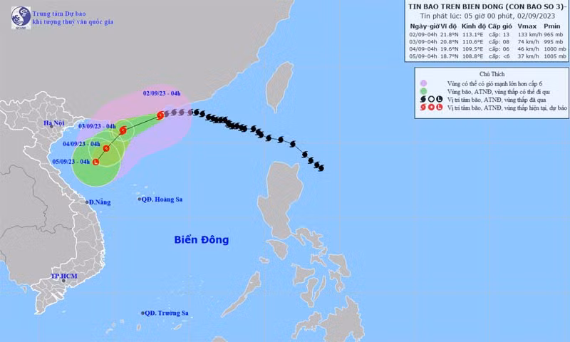
According to the National Centre for Hydro-Meteorology Forecasting, the typhoon is predicted to continue moving in the same direction, on September 3, at 10-15km per hour.
At 4am on September 4, its eye will be at 19.6 degrees north latitude and 109.5 degrees east longitude, in the northern waters of Hainan Island (China).
The central and southern parts of the central region will experience scattered showers and thunderstorms, with a rainfall of 10-30mm and over 70mm in some areas.
People are recommended to watch out for the risk of flash floods and landslides in mountainous areas and inundation in low-lying ones.
Heavy rains in short periods can cause flooding in urban areas, with a possibility of tornadoes, lightning, hail and strong winds during thunderstorms.