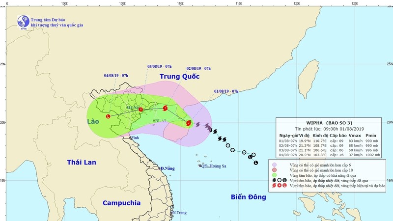
As of 7am on August 1, the storm is located at 360 kilometres from the northern coast, packing winds of up to 90 kilometre per hour near its eye, with gusts of over 120 kilometres per hour, the national weather service said.
Wipha is expected to enter the northern region of the Gulf of Tonkin later on the afternoon of August 1 and could gain further strength.
The storm is forecast to make landfall on August 2 and later weaken to a tropical depression as it moves further inland.
Due to the impact of tropical storm Wipha, heavy rains are expected to pummel the provinces in the northern and north-central regions with rainfall ranging between 100-300mm, and even 400mm in several locations.
In the capital Hanoi, the storm will also bring heavy rains and thunderstorms.
Warnings of flash flooding, landslides and river overflows have been issued for the northern region, especially in Quang Ninh, Lang Son, Bac Kan, Cao Bang, Ha Giang, Yen Bai, Lao Cai, Hoa Binh, Son La, Lai Chau, Thanh Hoa and Nghe An provinces.
Earlier the national disaster management agency had asked the localities on Wipha’s path to guide ships to safe shelter, ensure the safety of tourists on islands and impose a sea ban if necessary.
The agency also called for measures to secure the dyke system and reservoirs, and to prepare human and material resources to promptly respond in the event of disasters.
Wipha is the third storm to strike Vietnam this year.


