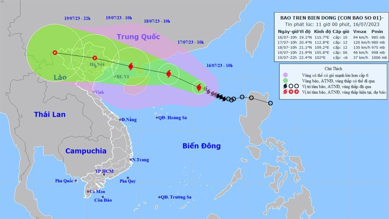
The strongest wind in the area near the centre of the storm was at level 9-10 (75-102 kilometres per hour), with shock at level 13.
As of 10am on July 17, the storm’s centre is projected to be 20.4 degrees north latitude and 112.8 degrees east longitude, about 280 kilometres to the east of Leizhou Peninsula. The strongest winds in the area near the centre of storm are expected to be at level 11-12, with shock at level 15.
The National Steering Committee for Disaster Prevention has requested localities from the northern province of Quang Ninh to the central province of Phu Yen to monitor the storm's progress and prepare responses.
The provinces are required to evacuate people in low areas with a high risk of flood due to heavy rain and sea level rises, at the same time as reinforcing houses, signs, public constructions, industrial parks, factories, warehouses and power grid systems.
Northern mountainous areas need to evacuate people in locations with high risk of flash floods and landslides and prepare all necessities and equipment to deal with the storm.


