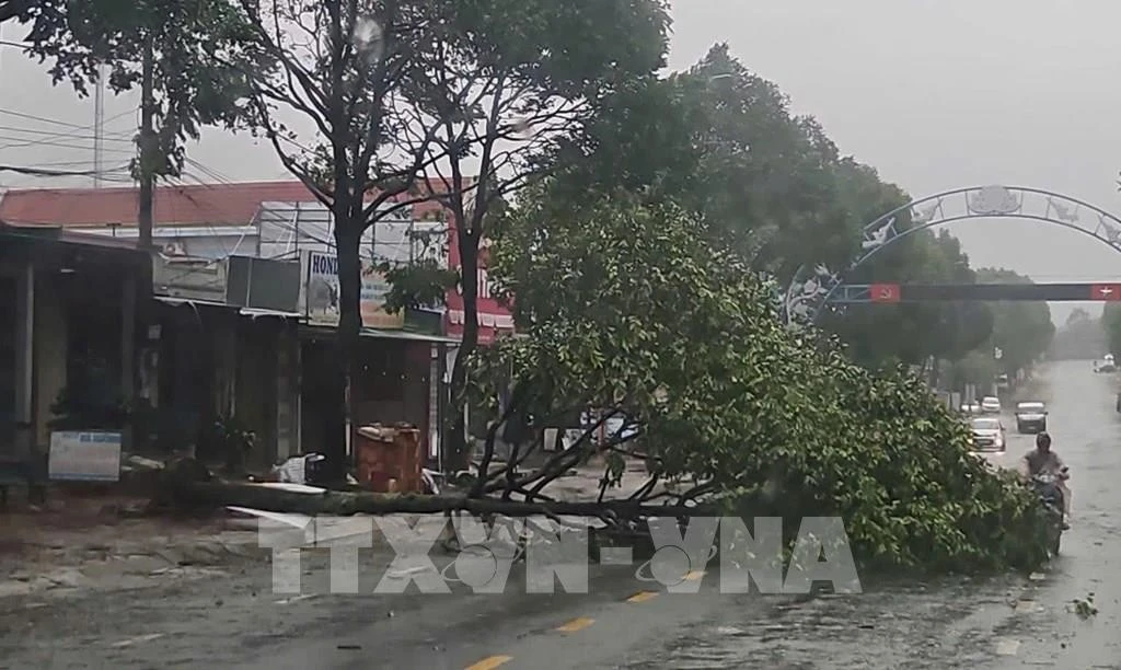
The storm has been causing widespread heavy rain from southern Quang Tri to Dak Lak, with rainfall ranging from 100 to 250mm, and in some areas exceeding 300mm.
At 10 p.m., the storm’s centre was located over Gia Lai and Dak Lak provinces. The strongest winds near the centre reached level 9 (75–88 km/h), gusting to level 11. The storm was moving west-northwestward at about 30 km/h.
By 10 a.m. on November 7, it is forecast to move into southeastern Thailand, weakening into a tropical depression with wind speeds below level 6. The affected areas include the sea from the southern Da Nang to Dak Lak and mainland localities from Quang Ngai to Dak Lak, with a level-3 disaster risk warning.
Authorities have warned of possible coastal flooding, storm surges, and high waves from Hue to Dak Lak, especially in low-lying areas. Coastal embankments, roads, and aquaculture zones may experience strong winds, rough seas, and rising tides, hampering drainage and increasing the risk of beach erosion. All vessels and aquaculture facilities in the affected areas are advised to take strict safety precautions.
From the night of November 6 to 7, heavy to very heavy rainfall is expected from southern Quang Tri to Dak Lak (100–250mm, locally over 300mm), while Khanh Hoa and Lam Dong will experience 70–150mm, locally exceeding 250mm. Rainfall is forecast to decrease from November 8.
Between November 7 and 8, moderate to heavy rain is expected from Thanh Hoa to northern Quang Tri, with total rainfall ranging from 50–150mm, and some places receiving over 200mm. Rain intensity may reach over 200mm within three hours in some areas.
The NCHMF reported that from 11:30 p.m. on November 6 to 4:30 a.m. on November 7, provinces from Quang Tri to Lam Dong will continue to experience rain, posing a risk of flash floods and landslides. The disaster risk level for flash floods, landslides, and ground subsidence caused by heavy rain and runoff is level 1.
Flash floods and landslides could cause severe environmental damage, threaten human safety, disrupt traffic, and destroy residential and economic infrastructure, leading to losses in production and socio-economic activities.
Following the storm’s landfall, Dak Lak province has reported initial damages. Local authorities and response forces have promptly deployed to key areas to assist residents and mitigate disaster impacts.
According to preliminary reports, Typhoon Kalmaegi has caused significant losses in Dak Lak, particularly in areas formerly under Song Cau township of Phu Yen province. During the night of November 6, the Ky Lo river rose rapidly as hydropower reservoirs released water, flooding several downstream localities in eastern Dak Lak. Military and police units have been dispatched to critical zones to support evacuation efforts and ensure the safety of residents.


