Harnessing the benefits of digitalisation
Ca Mau Province has 95,365 hectares of forest, of which special-use and protection forests account for 42,185 hectares, while the rest is classified as production forests. Notably, the province boasts diverse ecosystems rich in flora and fauna, including both mangrove and freshwater swamp forests.
To monitor, manage and protect its forests effectively, the provincial forestry sector and forest protection authorities have reviewed current information systems and databases, assessing their operational status, responsible agencies, connectivity and upgrade needs.
Data on changes in forest resources are updated in the sector’s information system based on inspection and verification results, while alerts are received, confirmed and logged together with details of the action taken.
Records on wildlife breeding facilities, forest product inventories and the handling of violations are regularly maintained through specialised software as part of day-to-day operations.
Head of the Nam Can Forest Protection Unit in Ca Mau Dang Quang Khoi said that in the past, managing and protecting 12,000 hectares of forest with just 12 staff relied mainly on direct patrols, inspections and periodic written reports, which required considerable time and labour.
Today, these manual methods have been replaced by software applications that help detect changes in forest cover early, enable prompt action against forestry violations, shorten processing times and cut staffing needs by about 60% compared with prescribed levels.
In addition, the unit has deployed dedicated software to manage around 400 wildlife breeding facilities in the area, which house about 6,000 animals of endangered, precious and rare species.
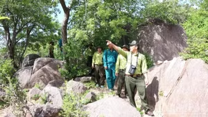
Meanwhile, U Minh Ha National Park has introduced specialised surveillance cameras and drones to monitor its forests from the air, enabling early detection of violations and fires. During field inspections, forest rangers use smartphones equipped with digital maps to pinpoint locations that require verification.
At Mui Ca Mau National Park, a specialised camera system has also been activated to support the monitoring and protection of forests, marine areas and coastal mudflats. The system enables park staff to promptly detect and deter illegal fishing, deforestation and unauthorised entry into protected areas.
Deputy Head of the Ca Mau Forest Protection Sub-department Truong Viet Bac said the province has gradually adopted technology in forest management and protection, starting with practical needs such as monitoring changes in forest resources, managing forest status maps and identifying locations in the field.
Its use has since expanded to include receiving alerts of forest loss and fires, as well as managing specialised forestry data.
Today, modern technologies, including AI-powered cameras, positioning devices, forest resource monitoring software, remote sensing and drones, have proved a breakthrough in optimising staff, improving accuracy and ensuring the timely detection and handling of forestry violations.
These technologies also provide valuable data for assessing the current state of forests and guiding plans to manage, conserve and restore mangrove ecosystems.

Overcoming challenges to advance digital transformation
Despite early progress, the sector’s digital transformation still faces notable obstacles.
Forest datasets are extensive and have been compiled over many years, meaning updates depend on on-site inspections and verification.
Changes detected in satellite imagery or by warning systems may reflect real shifts on the ground or simply discrepancies in the data, requiring field checks before conclusions are drawn.
Most server systems are managed by central agencies or other organisations, limiting the ability of local authorities to upgrade infrastructure, connect platforms, and share data promptly. Interoperability between systems is also constrained.
Deputy Director of Mui Ca Mau National Park Ly Minh Kha said practical challenges remain, particularly because of the park’s vast area, which covers forests, marine waters, and coastal mudflats.
Many areas are far from administrative centres, making network connectivity, data transmission and on-site updates difficult.
Infrastructure, equipment and software used for forest management and protection are not yet fully synchronised, while investment remains limited. Digital skills vary among staff, and data are still fragmented, without standardisation or integration into a unified database.
Deputy Director of the provincial Department of Agriculture and Environment Pham Van Muoi said that to enhance the application of digital technology in forest management and protection, the department’s leadership would direct the forestry sector, forest protection authorities and forest owners to ensure that digital data are accurate, complete, clean and continuously updated.
On that basis, he said, data systems would gradually be connected and information shared to support data-driven management and decision-making. Coordination among relevant agencies, forest owners and local authorities would also be strengthened to combine digital technology with patrols and field inspections.
The sector would further step up digital skills training for rangers and forest owners.
Investment in technology infrastructure and equipment would target key priorities, while pilot camera systems at national parks would be evaluated before deciding whether to expand them to other units.