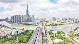
This strategic viewpoint is determined on the basis of practical requirements for Ha Noi to promote sustainable regional linkages, contributing to balance and harmony between urban and rural development, and between the advantages of the center and surrounding areas. According to planning orientation, Ha Noi’s development space will be expanded and closely connected with provinces and cities in the Capital Region under the model of a “radial urban cluster.”
Under the adjustment of the National Master Plan for the 2021–2030 period, with a vision to 2050, the country is reorganized into 34 provinces and centrally run cities and six key economic regions. The Capital Ha Noi is the center of the Capital Region, linked with five provinces: Phu Tho, Thai Nguyen, Bac Ninh, Hung Yen, and Ninh Binh.
According to the planning orientation, Ha Noi is the central urban area, playing the role of coordinating development in many important fields such as socio-economic development, science and technology, education and training, high-quality healthcare, and strategic transport infrastructure. Urban areas in surrounding provinces are identified as major satellite cities, both sharing functions and creating development counterbalances, contributing to the effective allocation of resources, services, and utilities for the entire region.
Architect Tran Ngoc Chinh, Chairman of the Viet Nam Urban Planning and Development Association, believes that clearly establishing Ha Noi’s role as the center, coordinating nucleus, and development driver for the Capital Region is of great significance. For many years, although Ha Noi has held the central position in politics, economy, science, education and training of the region, its leading role has only formed naturally, has not yet been institutionalized, and lacks coordination mechanisms.
Nguyen Duy Ngoc, Member of the Politburo and Secretary of the Ha Noi Party Committee, stated that regional development mechanisms will only truly be cohesive when localities jointly identify common development issues, the quality of satellite urban areas, and the vision for connection. Proposals for regional linkage between Ha Noi and localities need to build common standards in fields such as urban railways, inland waterways, road transport, metro systems, and environmental solutions for river systems to ensure synchronous and effective connectivity.
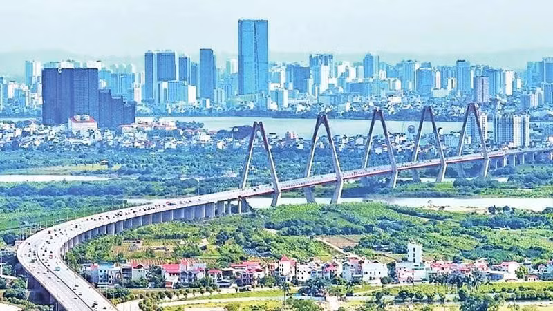
According to Permanent Vice Chairman of the Ha Noi People’s Committee Duong Duc Tuan, the structure of the Capital Region is a radial urban cluster, in which Ha Noi is the central urban area of the region. The regional linkage structure will help address difficult issues related to transport, environment, service provision, and spatial expansion, creating sustainable development; support, promote, and create momentum and new development space for provinces in the region; contribute to sharing burdens, reducing pressure on Ha Noi and developing together with Ha Noi.
Regarding regional linkage, Deputy Minister of Finance Tran Quoc Phuong stated that it is necessary to further deepen coordination content between Ha Noi and provinces in the Capital Region, ensuring consistency in viewpoints and planning orientations of each locality; at the same time, it is necessary to study and perfect a regional coordination model with binding mechanisms and clear commitments to avoid fragmented and unsynchronized implementation.
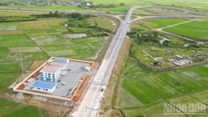
In recent times, with a regional linkage mindset, localities in the region have proactively established planning and implemented investment. Nguyen Huu Nghia, Member of the Party Central Committee and Secretary of the Hung Yen Provincial Party Committee, emphasized that the province’s planning for the 2021–2030 period identifies comprehensive transport infrastructure connectivity with Ha Noi as a consistent orientation; including planning six bridges across the Red River.
Hung Yen proposed studying the addition of Trieu Duong Bridge, connecting Provincial Road 427 of Hung Yen with Thuong Tin commune (Ha Noi); at the same time, clearly defining the alignment of Dong Ninh Bridge connecting Provincial Road 429 (Van Diem area) with Hung Yen’s heritage road, ensuring consistency with Ha Noi’s Ring Road 4 and Ring Road 5 planning.
Pham Dai Duong, Member of the Party Central Committee and Secretary of the Phu Tho Provincial Party Committee, said that Phu Tho shares 290 km of border with Ha Noi, with two major rivers, the Red River and Da River, flowing through its territory. The province proposed that Ha Noi strengthen coordination in resolving inter-regional issues, especially regarding environment, transport, population distribution, and industrial development.
In its planning, the province has proactively adjusted its orientation to attract industrial zones to reduce pressure on Ha Noi’s inner city; at the same time, take advantage of the development momentum of Hoa Lac High-Tech Park to spread to adjacent areas, including urban development, high-tech industries, and backup data centers.
With Ha Noi’s role as the leading nucleus and the proactive companionship of provinces, the “picture” of regional development is being sketched with major ideas, laying the foundation for sustainable, connected, and mutually supportive development, expanding development space and creating new values and growth drivers.


![[Video] Resolution No. 10 repositions FDI in Viet Nam's new development strategy](https://en-cdn.nhandan.vn/images/5992a12dd6e78b9bfb434962ff1830731c3ef6c1538d722fbb2593b0fa31ecfea73ea406e335bb4f889623e75863a3fa5de1ba084f5b1db0b5788c84a44f1d4c/anh-dai-dien.jpg.avif)