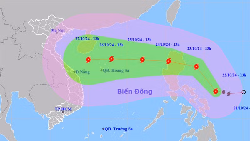
On the afternoon of October 22, Vu Anh Tuan, deputy head of the Weather Forecasting Department at the National Centre for Hydro-Meteorological Forecasting, said that Typhoon Trami is currently over the eastern waters of the central Philippines and is expected to move northwest.
According to Tuan, by October 24, Typhoon Trami is expected to enter the East Sea and become Storm No. 6 for the East Sea in 2024. After entering the East Sea, the storm is projected to move westward, with its intensity likely to increase further.
“According to initial forecasts, when Typhoon Trami passes the Hoang Sa (Paracel) Archipelago, it will reach level 12, with gusts up to level 15, and will continue heading towards the Vietnam’s central provinces,” Tuan said.
From around October 26 to 28, the central provinces are likely to experience widespread heavy rains due to the impact of Typhoon Trami.
This is the initial information on Typhoon Trami. Late-season storms often develop in complex ways, so people should regularly update themselves on forecasts to monitor the storm’s progress, according to Tuan.