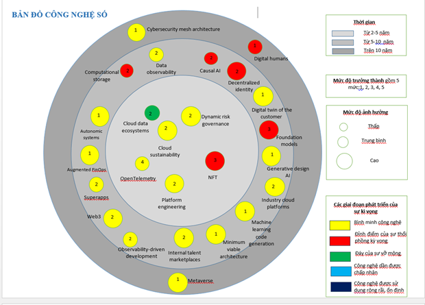
The maps are about technologies used in the eight areas of telecommunications, post, journalism, publication, digital government, information safety, digital university and digital technology.
Each technology map includes a description and assessment of each technology, and infographics showing brief information on technologies impacting the area such as development level, impact level, and stages of expectations for the technologies by time.
The maps are expected to be a tool for state management agencies in mangement work, making stragies, building short, medium and long-term implementation plans in line with the development of technology.
The maps will also support units and businesses in making decisions about the application and deployment of new technologies.


