Building real-time flood warning system in Quang Tri
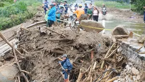
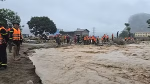
Quang Tri Province has long been among the localities most severely affected by storms and floods. While engineering solutions such as reservoirs, dykes, flood diversion, and population relocation have proven effective, they demand substantial funding and long investment timelines, whereas the nature of disasters is evolving ever more rapidly.
This reality underscores the urgent need to develop early warning tools based on real-time data, modern mathematical models, and rapid information transmission technology.
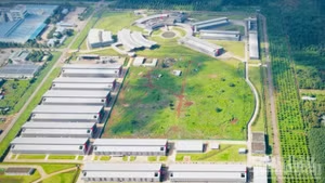
Responding to this demand, the Ministry of Science and Technology tasked the National Key Laboratory of River and Marine Dynamism with the project “Research on Applying Advanced Technology to Build an Early Warning System for Flood and Inundation Disaster Risks in Quang Tri Province and Adjacent Areas”, led by Associate Professor Dr Nguyen Thanh Hung.
The project sets out three strategic objectives. The first is Disaster Risk Mapping, which involves producing detailed flood and inundation risk maps down to commune level to directly support prevention efforts.
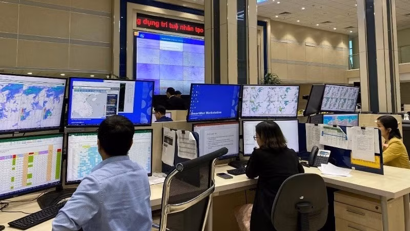
The system is designed to send warnings and guidance directly to people via mobile phones, websites, and social media, ensuring vital information reaches the right places at the right time.
The second is Real-Time Warning Technology, aimed at creating advanced early warning systems for flood and inundation risks based on hydro-meteorological forecasts.
The third is Transmission and Response Systems, focusing on developing technology for disseminating warnings and proposing suitable and effective response plans.
To achieve these goals, the research team undertook six main tasks, focusing on in-depth data collection and analysis alongside breakthrough technology applications.
The system’s effectiveness lies in its integration of several advanced technologies. First is the physics-based mathematical model. The team developed a suite of flood simulation and risk assessment tools using a physical approach, simulating the dynamics of flow, rainfall, terrain slope, and hydrological factors to generate realistic forecasting scenarios.
Artificial intelligence (AI) and machine learning serve as the “enhanced brain”. Dr Hung and colleagues trained the system on large multi-year datasets, producing 282 different scenarios for disaster warnings.
With AI support, processing speed and forecast issuance are significantly shortened – a critical factor in disaster prevention and control that demands real-time responses.
")
Another pillar is integrated information transmission technology. The system is designed to send warnings and guidance directly to people via mobile phones, websites, and social media, ensuring vital information reaches the right places at the right time.
The project’s initial results were pilot-tested during the 2024 flood season in Quang Tri. The real-time forecasts and warnings based on the new model received high praise from management agencies and experts for their comprehensiveness, modernity, and ability to meet urgent local needs.
Coastal forecasting models for storm surge and waves
Beyond the central region, many coastal stretches of Viet Nam face severe inundation risks from the combined impacts of strong storms, sea level rise, and large waves.
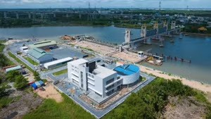
In response, the National Centre for Hydro-Meteorological Forecasting launched the national-level project “Building a Model Suite and Technological Process for Forecasting Coastal Inundation due to Storm Surge and Waves”, led by Associate Professor Dr Nguyen Ba Thuy, running from December 2022 to November 2025.
The project aims to master integrated atmosphere-wave-surge computation models and develop forecasting processes suited to Viet Nam’s coastal conditions.
")
The research team completed data collection and processing on meteorology, hydrology, oceanography, and topography, while integrating three advanced models, including WRF (Weather Research and Forecasting) for storm wind simulation, SWAN (Simulating WAves Nearshore) for wave simulation, and ADCIRC (ADvanced CIRCulation) for surge simulation.
The system enables detailed simulation of storm interactions with coastal terrain, thereby forecasting inundation levels for specific scenarios. The model was tested in Thanh Hoa Province at a 1:10,000 map scale, assessing inundation for storm levels 11–14, with and without seawalls, combined with various tidal timings.
The products have been transferred to localities for evacuation planning, protection of vessels, aquaculture areas, and dyke infrastructure. The forecasting toolkit was trialled during the 2025 storm season and demonstrated high accuracy against actual data.
Hoang Duc Cuong, Deputy Head of the Hydro-Meteorological Department, noted that the project has made an important contribution to improving early warnings for coastal areas, aligning with the sector’s modernisation goals.
Amid increasingly extreme disasters, developing integrated forecasting models that apply AI, big data, and rapid communication technology is the right direction for Viet Nam to perfect a national-scale early warning system.
A notable feature is the model’s separate forecasting processes for two terrain types: areas with dykes and areas without. Seawalls strongly influence wave and surge propagation, necessitating distinct forecasting methods. This makes the model suitable for coastal provinces with varying shoreline structures, from Thanh Hoa and Hue to Khanh Hoa, Vinh Long, and Ca Mau.
According to Dr Thuy, the model also enhances forecasters’ capabilities. However, real-time operational deployment still requires investment in high-performance computing systems.
Both projects demonstrate Viet Nam’s growing expertise in mastering modern disaster simulation and warning technologies. Though difficult to quantify directly in economic terms, the indirect benefits from damage reduction are immense.
Amid increasingly extreme disasters, developing integrated forecasting models that apply AI, big data, and rapid communication technology is the right direction for Viet Nam to perfect a national-scale early warning system.
This is not only the goal of the meteorology and hydrology sector but also a core requirement for sustainable socio-economic development, particularly in high-risk localities.

![[Video] Viet Nam to allocate at least 2% of annual state budget for environmental protection](https://en-cdn.nhandan.vn/images/8f440db7b9bfe62cb5397a6750a8b01baf75985d773fc6617e8284531240c6f952553ffd2d04ad2cc22885322a297da9e9025c2d7944d75148de8ee1664be9e4/31-7-5074.jpg.avif)