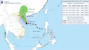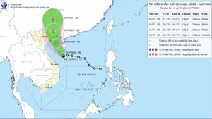
For the next 12-24 hours,the location of the storm will be around 18.5 degrees north latitude and 113.8 degrees east longitude,about 270 kilometres north-northeast of the Hoang Sa Archipelago. The strongest winds near the centrewill be atlevel 12-13, withshock at level 15, and it will movewest-southwestat a speed of 15 kilometres per hour.
24-48 hours from now,the storm’s centre will be about 17.5degrees north latitude and 109.5 east longitude, about 200 kilometres north-northwest of the Hoang Sa Archipelago. The strongest winds near the eye will be at level 10-11, with shock at level 13, andit move west-northwestat a speed of 15 kilometres per hour.
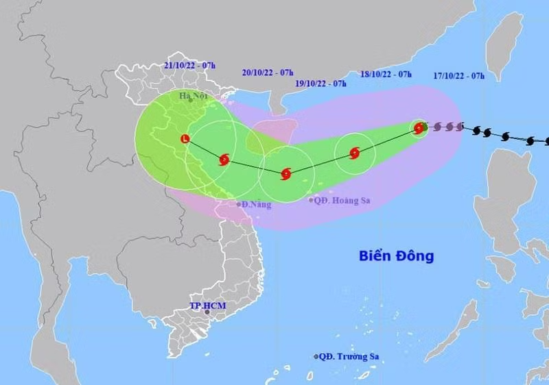
In the next 48-72 hours, the storm will move mainlywestwardswith a speed of about 10-15 kilometres per hour and gradually weaken.
72 to 96 hours from now,the storm will movewest-northwestat a speed of 10 kilometres per hour and gradually weakeninto a tropical depressionand then into a low pressure area.
Due to the influence of storm No. 6,the northern area of the East Sea/South China Sea (including the waters of the Hoang Sa Archipelago)experiences heavy rains and strong winds of level 9-10 that will increaseto level 11-13 and then level 15. The middle of the East Sea, including the waters north of theTruong Sa(Spratly) Archipelago, will be facingstrong showers and thunderstorms.
During the day and night of October 18, in the Gulf of Tonkin, the sea from Quang Tri to Quang Ngai will havestrong winds of 6-7,with level 8-9.