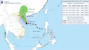
As of 4pm on July 22, the storm was located in the area from Ninh Binh to Thanh Hoa, with the strongest winds near its centre reaching 62-74 kilometres per hour and gusts of 89-102 kilometres per hour.
The system is moving westward at a speed of 10-15 kilometres per hour.
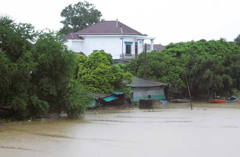
Heavy rain of 50-100mm is expected in Thanh Hoa, Nghe An, southern Phu Tho and Son La from the late afternoon of July 22 to the next morning, with precipitation of over 200mm in some places.
Other areas in northern Viet Nam and Ha Tinh Province may experience rainfall of 20-40mm, and over 100mm in some locations.
The weather agency said there is a risk of high-intensity rain (over 150mm in three hours), which could cause flash floods and landslides in mountainous regions and flooding in low-lying areas.
Over the next 24 hours, Wipha is expected to weaken to a tropical depression and then a low-pressure area as it moves further inland towards Laos.