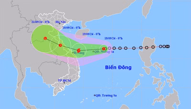
The National Centre for Hydro-Meteorological Forecasting reported that the centre of the tropical depression was about 250 km east of the Vietnam’s Hoang Sa (Paracel) archipelago at 4AM on September 18. The strongest winds reached level 7 (50-61 km per hour), with gusts up to level 9, and the depression is moving mainly westward at a speed of around 25 km per hour.
It is forecast that within the next 24 hours, the tropical depression is likely to strengthen into a storm with winds reaching level 8, and gusts up to level 10.
Specifically, around 4AM on September 19, the tropical depression will change direction, moving west-southwest and slowing down to a speed of 15-20 km per hour. It will intensify into a tropical storm (No. 4) about 340 km east-southeast of the coast between Quang Binh and Da Nang.
Around 4AM on September 20, storm No. 4 will be near the coastal areas between Quang Binh and Da Nang, moving west-northwest at a speed of about 15 km per hour. The strongest winds near the storm’s centre will remain at level 8, with gusts up to level 10.
48 to 72 hours from now, the storm will move west-northwest at a speed of 10-15 km per hour and is expected to weaken into a tropical depression over central Laos.