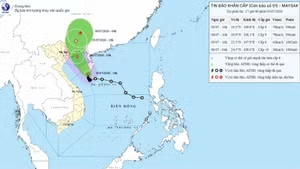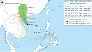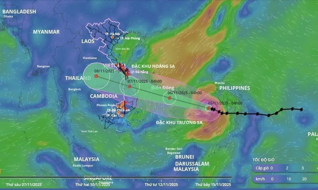
At 1:00 am on November 5, the centre of Kalmaegi, the 13th storm in the East Sea/ South China Sea this year, was at around 11.3 degrees North latitude and 119.9 degrees East longitude, over the northern area of the Palawan Island of the Philippines, about 610 km east of Song Tu Tay Island. The strongest winds near the storm’s eye reached Level 13 (134–149km/h), with gusts up to Level 16. It was moving west-northwest at a speed of 20–25 km/h.
By 1:00 am on November 6, the typhoon is forecast to be about 610 km east-southeast of Gia Lai province’s coast, with winds at Level 14, gusting up to Level 17. It is expected to move west-northwest at around 25 km/h.
By 1:00 am on November 7, the typhoon is predicted to make landfall along the coast from Quang Ngai to Dak Lak, sustaining winds at Level 12 with gusts up to Level 15. It will continue moving west-northwest at some 25 km/h.
By 1:00am on November 8, it is expected to move over southeastern Thailand with wind speeds below Level 6, and gradually weaken into a low-pressure system.
")
Due to Kalmaegi impacts, the central area of the East Sea/ South China Sea, including the northern waters of Truong Sa special zone, will experience strong winds of Level 8–11, increasing to Level 12–14 with gusts up to Level 17 near the storm’s centre. Waves are forecast to reach 5–7 metres high, and 8–10 metres near the eye of the storm, causing extremely rough seas.
From November 6 morning, sea areas off the coast from Da Nang to Khanh Hoa will see winds strengthening to Level 6–7 and later Level 8–11, even up to Level 12–14 with gusts reaching Level 17 near the storm’s centre.
From November 6 evening, coastal areas from Hue city to Dak Lak should be on alert for rising sea levels and large waves, which may cause flooding in low-lying areas, overtopping of sea dykes, coastal road damage, and shoreline erosion, as well as slowing flood drainage. All vessels, boats, and aquaculture farms in the affected areas are expected to be severely impacted by thunderstorms, strong winds, high waves, and storm surges.
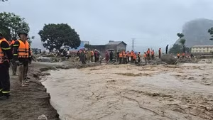
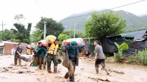
Due to the storm’s wide circulation, there is a high risk of thunderstorms, whirlwinds, and strong gusts both before and during landfall. Heavy rainfall is predicted for several areas, including the central coastal region, the Central Highlands, and the southern region, with potential flash floods on small rivers and streams, landslides on slopes, and flooding in low-lying, urban, and industrial areas.
In response to the typhoon, authorities of Quang Ngai province are urgently implementing response measures to minimise storm damage.
Officers and soldiers from the Sa Huynh border guard station have been on duty at the Sa Huynh fishing port, checking vessels and using loudspeakers to urge fishing boats to seek shelters.
A working team led by Colonel Vo Van Ba, Deputy Chief of Staff of Military Region 5, directly inspected response efforts in Sa Huynh ward. Relevant forces have been directed to prepare equipment and personnel, ready to take action in the face of Kalmaegi.
Under the storm impact, Quang Ngai province is likely to experience heavy rainfall, reaching 100–250 mm, with some areas exceeding 300 mm.