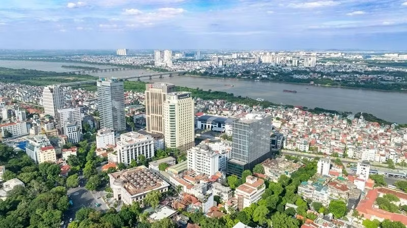
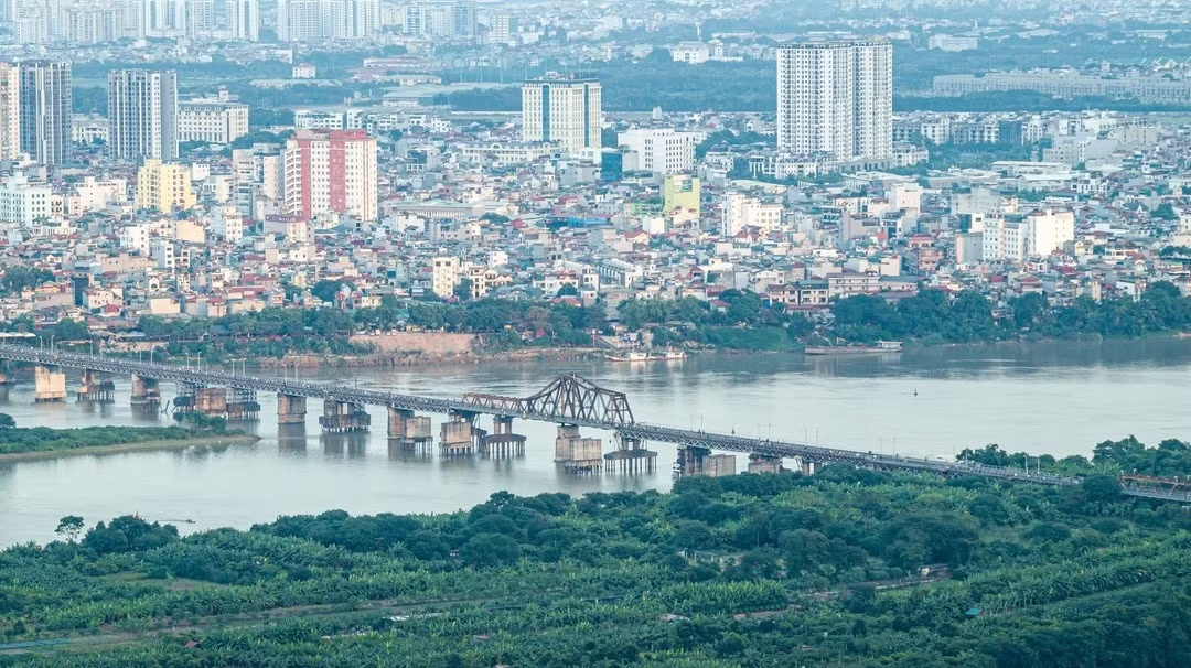
The overall revision of the Red River urban zoning plan, covering a stretch of about 40 km from Hong Ha Bridge to Me So Bridge, is significant not only for Ha Noi’s urban spatial organisation but also for the country and the wider region.
Far-reaching impact on local communities
In line with a Politburo resolution issued in March 2026 on building and developing Ha Noi in the new era, as well as with the capital’s master plan with a 100-year vision, the Red River has been identified as the main ecological and cultural landscape axis and a new symbol of development in Ha Noi’s long-term spatial structure.
If the complex challenges involved can be resolved, the plan can become a model for sustainable urban development in Viet Nam.
The revised Red River urban zoning plan covers a total area of more than 11,400 hectares and will have a substantial impact on local communities.
More than 279,500 people currently live within the planning area, in 16 communes and wards, with residential land covering more than 1,100 hectares.
The greatest challenge, and the main obstacle to many earlier proposals for both banks of the Red River, is the need to control flooding and ensure the safety of riverside communities and the city as a whole.
Architect To Anh Tuan, Chairman of the Ha Noi Urban Planning and Development Association, said development along the Red River depends first and foremost on the ability to manage flood risks.
A review has identified 123 heritage sites and 12 clusters of craft villages and traditional settlements in the planning area.
Communities have been living and developing along the river for thousands of years, and the soul of the Red River’s riverside landscape lies in its people, customs and village culture.
Ancient villages and traditional craft villages provide livelihoods for thousands of households and embody a distinctive cultural heritage that shapes the capital’s identity.
![[Video] Ha Noi plans five more bridges across Red River by 2038](https://en-cdn.nhandan.vn/images/0747_ciVMvQhL5NgCvqCa8pqVjGitzLu_er9sIXySj3n30WySj8Lj0kfAIg3cIgy/bridge.png.avif)
Associate Professor Bach Thanh Dinh, Chairman of the Advisory Council on Ethnic and Religious Affairs of the Viet Nam Fatherland Front Committee of Ha Noi, said the plan must take into account extreme natural disasters and flooding caused by climate change, as well as unforeseen incidents, rather than relying solely on normal hydrological conditions.
He added that, in developing new urban areas and resettlement housing, planners must work out how the residents will live and earn a living.
On-site resettlement is not just about providing housing. It is also closely tied to preserving traditions, craft villages and cultural values handed down through generations.
Speaking on behalf of local residents, Le Van Hoang, Secretary of a Party cell in Hong Ha Ward, proposed that the city continue to examine existing conditions in each area carefully and prioritise retaining established residential communities wherever conditions permit, particularly those that have been settled for generations.
In areas where land acquisition is genuinely necessary, he said, priority should be given to resettlement close to residents’ existing homes, with living conditions at least equivalent to, if not better than, their previous ones, while enabling them to keep their jobs, schooling, daily routines and community ties.
Following public consultations on the plan, Truong Tu Uyen, Chairwoman of the Viet Nam Fatherland Front Committee of Phu Thuong Ward, said residents were most concerned about site clearance, compensation, assistance, resettlement and livelihood stability.
She said the authorities must provide transparent information and take residents’ concerns into account to help build consensus.
Applying the most favourable policies for residents
Vu Dai Thang, Chairman of the Ha Noi People’s Committee, said the city authorities had instructed relevant departments, agencies and organisations to proceed with great care and thoroughness, relying on scientific calculations and strictly complying with legal procedures and regulations.
They have been tasked with carefully examining requirements for flood drainage safety, dykes, spatial organisation, and socio-economic development, while striking a balance between modern urban development, heritage preservation and the renovation of traditional villages.
Regarding resettlement, compensation and site clearance, the city is considering applying the most favourable policies permitted under the Capital Law.
The city will not put residents in temporary accommodation but will strive to provide resettlement housing on-site or close to residents’ existing homes, with coordinated social and technical infrastructure.
Resettlement areas and their infrastructure will be built before site clearance begins.
The revised Red River urban zoning plan sets out a large-scale, systematic and modern strategy for infrastructure investment across the area.
One issue drawing considerable attention from experts is how to improve access to the river and to facilities along both banks for residents and visitors alike.
The proposed landscape boulevard should therefore be designed to serve people, prioritising pedestrian spaces, parks, cultural activities and tourism services, rather than becoming a high-speed expressway that divides public open spaces.
Architects argue that planning for the Red River should not mean densely developing both banks into a continuous urban strip.
Instead, the plan must respect the river itself, its floodplains and inland urban areas, while avoiding disruption to the area’s historical and cultural continuity.

Another important consideration is protecting riverside ecosystems.
Alluvial plains, seasonally flooded areas and natural green corridors serve as the city’s lungs and are particularly valuable assets for a metropolis such as Ha Noi.
Under the proposed plan, an extensive network of floodable parks will be developed. These areas will serve as public spaces for recreation and services in the dry season and let floodwaters flow freely in the flood season.
This reflects a nature-based approach that embraces living with floods rather than relying solely on rigid flood-control measures.
The key challenge is to ensure feasibility and sustainability while balancing livelihoods, infrastructure, the environment, and safety from natural hazards — factors that must not be compromised and cannot easily be restored once damaged.
If the river truly becomes a new space for development, its ecosystems are protected, the value of traditional craft villages is recognised, infrastructure is developed in a coordinated way and natural disasters are addressed through adaptive, nature-based planning, then the Red River urban zoning plan can become a living model of sustainable urban development for both the capital and the country.
Once a dividing line between communities on opposite banks, the Red River is now expected to become a “pink silk ribbon” linking past, present and future, bringing together growth and conservation and, most importantly, connecting urban development with the lives of residents — who are both the driving force and the ultimate beneficiaries of renewal.