The typhoon’s circulation, combined with cold air and easterly disturbances, is expected to trigger a prolonged period of heavy rainfall lasting until the weekend in provinces from Ha Tinh to Quang Ngai, with rainfall totals potentially reaching up to 900mm and posing a high risk of flooding above level 3 alert.
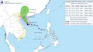
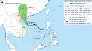
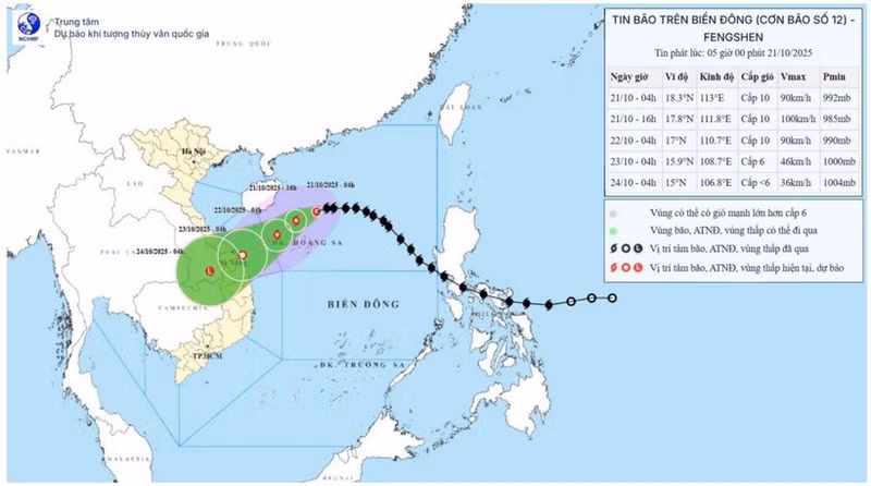
According to the National Centre for Hydro-Meteorological Forecasting, the typhoon’s centre was located at approximately 18.3°N latitude and 113.0°E longitude at 4 am on October 21, around 200km northeast of the Hoang Sa Archipelago. The strongest winds near the typhoon’s centre were at level 9–10 (75–102km/h), with gusts reaching level 12. The typhoon is moving westward at about 20km/h.
By 4 am on October 22, the typhoon is forecast to move west-southwest at a speed of 10–15km/h. The typhoon’s centre is expected to be near 17.8°N latitude and 110.7°E longitude, over the northwestern sea of the Hoang Sa Archipelago.
The strongest winds near the centre will remain at level 9–10, gusting to level 12. Disaster risk level: Category 3 over the western waters of the northern East Sea/South China Sea (including the Hoang Sa Archipelago).
By 4 am on October 23, the typhoon will continue moving west-southwest at about 10km/h. The centre will be near 15.9°N latitude and 108.7°E longitude, over coastal waters from Hue to Quang Ngai. The strongest winds near the centre will weaken to level 6, gusting to level 8, and it is expected to gradually downgrade into a tropical depression.
By 4 am on October 24, the typhoon will move southwest at about 10km/h. Its centre will be located around 15.0°N latitude and 106.8°E longitude, over southern Laos, and it will further weaken into a low-pressure area with maximum winds below level 6.
Due to the typhoon’s influence, the northern part of the East Sea (including the Hoang Sa Archipelago) will experience strong winds at level 7–8; areas near the typhoon’s centre will have winds at level 9–10, gusting to level 12; wave heights of 3–5m, rising to 5–7m near the centre, causing very rough seas.
The sea areas from southern Quang Tri to Quang Ngai (including the Ly Son Island) will see winds at level 6, increasing to level 7 by the morning of October 22; near the typhoon’s path, winds may reach level 8, gusting to level 10, with waves of 3–5m and rough seas.
All vessels operating within these dangerous zones will likely be affected by thunderstorms, whirlwinds, strong winds, and high waves.
On land, due to the combined effects of the typhoon’s circulation, cold air, easterly wind disturbances, and orographic influences, from the night of October 22 - 26, areas from Ha Tinh to Quang Ngai are expected to experience widespread heavy rainfall.
Total rainfall is forecast to reach 200–400mm in Ha Tinh, northern Quang Tri, and Quang Ngai, with some locations exceeding 500mm; from southern Quang Tri to Da Nang, rainfall will range from 500–700mm, and some areas may exceed 900mm. Heavy rain across the central region is likely to persist until the end of October 2025.