During the same period, the areas from southern Quang Tri to Hue, Khanh Hoa, and Lam Dong are likely to experience heavy rain, with totals ranging from 150–300mm, locally exceeding 450mm, according to the National Centre for Hydro-Meteorological Forecasting (NCHMF).
Downpour is expected to ease from November 8, though northern Quang Tri to Thanh Hoa will see moderate to heavy rain of 50–150mm, with some areas possibly exceeding 200mm. Intense rainfall of over 200mm per three hours are also predicted.
Due to the storm’s wide circulation, authorities have warned of thunderstorms, strong gusts, and tornadoes both before and during landfall.
Mai Van Khiem, Director of the NCHMF, noted that Kalmaegi is a strong and fast-moving storm with a broad circulation, with a track and pattern of impact similar to Typhoon Damrey (2017) and Typhoon Molave (2020).
At 10:00 on November 5, Kalmaegi's eye was at about 11.6 degrees North and 118.4 degrees East, some 450km east of Song Tu Tay Island. The storm sustained the strongest winds of Levels 13–14 (134–166 km/k), gusting up to Level 17. It was moving west-northwest at about 20km/h.
As of 10:00 on November 6, it is forecast to be about 340km east-southeast of Quy Nhon (Gia Lai province), packing winds of Level 14, with gusts of Level 17, moving west-northwest at around 25km/h. It is expected to affect the central part of the East Sea/ South China Sea, including northern Truong Sa (Spratly) waters, with a disaster risk level of 4.
By 22:00 on the same day, Kalmaegi will be on Quang Ngai – Dak Lak waters, sustaining Level-13 winds, gusting to Level 16, still moving west-northwest at 25km/h. The affected areas include the western central East Sea/ South China Sea, Quang Ngai – Dak Lak waters (including the Ly Son special zone) and coastal zones from southern Quang Tri to Da Nang, all at disaster risk levels 3–4.
At 10:00 on November 7, the storm is expected to hit southern Laos, gradually weakening to a tropical depression with Level-7 winds, gusting to Level 9. By 22:00 the same day, it will have moved into Thailand, with winds below Level 6, and continue to weaken.
In response to Kalmaegi’s complex developments, Dak Lak province has issued a ban on all fishing and marine activities from 06:00 on November 5. The provincial Department of Education and Training has ordered schools in coastal communes likely to be directly affected to close from the afternoon of November 5 until November 7.
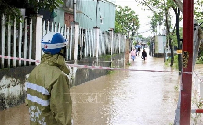
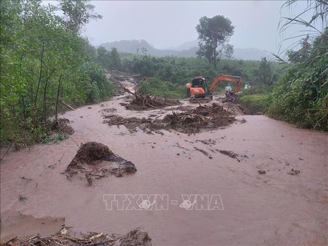
Meanwhile, Quang Tri province has directed localities and agencies to actively implement emergency response measures. Meanwhile, efforts are also being made to address the aftermath of the recent widespread flooding, including environmental clean-up, disinfection, infrastructure restoration, and free medical treatment for the injured. Authorities are identifying households in need of food and shelter and preparing to evacuate residents from high-risk areas threatened by landslides, flash floods, and deep inundation, with particular attention to vulnerable groups.
As of 06:00 on November 5, flooding in Quang Tri had resulted in nine deaths, one person missing, and four injured. The province reported 71 flooded sites, 40 landslide-hit locations, over 10,900 inundated households (more than 23,300 people), and 433 others (over 1,300 residents) isolated by floodwaters. Sixty-five schools were forced to suspend classes, affecting over 17,700 students.
