The centre warned that from midday October 22 to October 27, widespread downpour will affect the areas from Ha Tinh to Quang Ngai, with the most intense precipitation expected between the afternoon of October 22 and the end of October 23. From the southern part of Quang Tri to Da Nang, rainfall could reach 500–700mm, with some places over 900mm. Rainfall intensity may exceed 200mm within three hours.
From the afternoon of October 22, the storm’s circulation, combined with a strong cold front, will bring increasingly strong winds along coastal areas from Quang Tri to Da Nang.
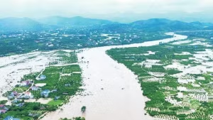
Heavy rain in the central region may persist until the end of October, with high risks of flash floods, landslides in mountainous areas, and flooding in low-lying and urban zones.
Director of the centre Mai Van Khiem advised the affected localities to ensure safety for hydroelectric and irrigation reservoirs before, during, and after the storm, and prepare flood response plans for rivers from Quang Tri to Quang Ngai, where water levels could reach or exceed Level 3. The disaster risk due to flooding is forecast at Level 3.
Precautions are also necessary against thunderstorms and tornadoes with strong gusts during the storm’s approach and landfall, he said.
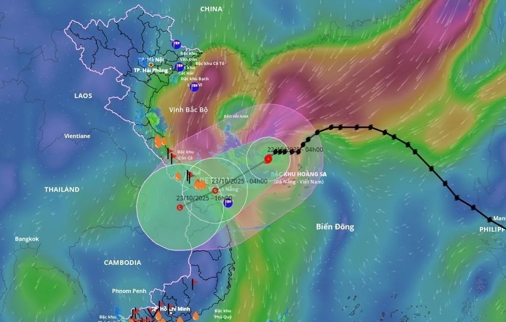
At 7 am on October 22, Fengshen’s eye was located at approximately 17.1°N and 110.7°E, over the northwestern waters of the Hoang Sa special zone, about 280km east-northeast of Da Nang. Maximum winds near the centre were about 89–102 km per hour. The storm was moving west-southwest at about 10 km per hour.
By 7 am on October 23, it is expected to reach the coast from Hue to Quang Ngai, continuing the west-southwest direction at 10–15 km per hour and gradually weakening into a tropical depression. The affected areas include the western part of the northern East Sea, including Hoang Sa and the waters from Quang Tri to Quang Ngai, including the special zones of Con Co and Ly Son, and Cu Lao Cham Island. The disaster risk remains at Level 3.
By 7 pm on October 23, the storm will move over southern Laos, abating further into a low-pressure area.
